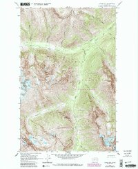
1963 Map of Agnes Mtn.
USGS Topo · Published 1987About this map
Agnes Mtn and the surrounding high alpine landscape dominate this mid-twentieth-century survey of the North Cascades. The map details the drainage patterns of the Agnes Creek watershed, including its primary tributaries like West Fork Agnes Creek and South Fork Agnes Creek. High-elevation features define the area, from the perpetual ice of Chickamin Glacier and Blue Glacier to the sharp relief of Sawtooth Ridge and Needle Peak.
Find a feature on this map
28 named features on this map. Tap any name to fly to it.
Don’t see what you’re looking for? This feature index may not catch every label — zoom into the map to look around manually.
Map Details
Editions of this 1963 Agnes Mtn. Map
4 editions found
Other maps of this area

1899 · Glacier Peak
USGS Topo · 1:125,000

1901 · Glacier Peak
USGS Topo · 1:125,000

1902 · Stehekin
USGS Topo · 1:125,000

1904 · Stehekin
USGS Topo · 1:125,000

1944 · Holden
USGS Topo · 1:62,500

1949 · Holden
USGS Topo · 1:62,500

1950 · Glacier Peak
USGS Topo · 1:62,500

1955 · Concrete
USGS Topo · 1:250,000

1958 · Concrete
USGS Topo · 1:250,000

1962 · Concrete
USGS Topo · 1:250,000