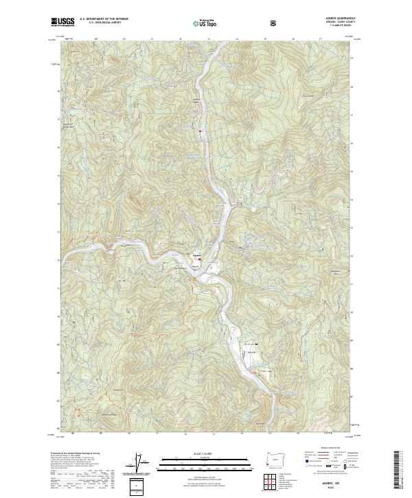
2024 Map of Agness
USGS Topo · Published 2024About this map
The confluence of the Rogue River and Illinois River anchors this 2024 map of Agness, Oregon, a region defined by its rugged river systems and designated wilderness. The settlement of Agness is positioned near the junction of these major waterways, supported by river-adjacent features like Agness Bar and Walker Bar. The presence of the Oak Flats Cem near the Oak Flat settlement provides a touchstone for local family histories, while the Bolan Lake Dam indicates water management within the intricate drainage of Tom Fry Creek and Old House Creek.
Find a feature on this map
70 named features on this map. Tap any name to fly to it.
Don’t see what you’re looking for? This feature index may not catch every label — zoom into the map to look around manually.
Map Details
Editions of this 2024 Agness Map
This is the sole edition of this map. No revisions or reprints were ever made.
Other maps of this area

1899 · Port Orford
USGS Topo · 1:125,000

1903 · Port Orford
USGS Topo · 1:125,000

1917 · Kerby
USGS Topo · 1:125,000

1918 · Kerby
USGS Topo · 1:125,000

1945 · Kerby
USGS Topo · 1:125,000

1954 · Coos Bay
USGS Topo · 1:250,000

1954 · Marial
USGS Topo · 1:62,500

1954 · Collier Butte
USGS Topo · 1:62,500

1954 · Agness
USGS Topo · 1:62,500

1954 · Pearsoll Peak
USGS Topo · 1:62,500