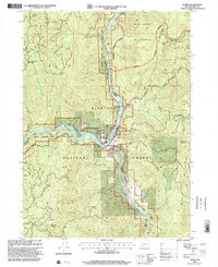
1998 Map of Agness
USGS Topo · Published 2001About this map
The confluence of the Rogue River and the Illinois River serves as the focal point for the settlement of Agness, located within the expansive Siskiyou National Forest. This 1990s revision details a landscape defined by deep river canyons and high peaks like Sevenmile Peak and Raspberry Mountain. The presence of the Agness Cem, a Hotel, and a P.O. indicates a remote but established community center that historically served as a gateway for river travel.
Find a feature on this map
66 named features on this map. Tap any name to fly to it.
Don’t see what you’re looking for? This feature index may not catch every label — zoom into the map to look around manually.
Map Details
Editions of this 1998 Agness Map
This is the sole edition of this map. No revisions or reprints were ever made.
Other maps of this area

1899 · Port Orford
USGS Topo · 1:125,000

1903 · Port Orford
USGS Topo · 1:125,000

1917 · Kerby
USGS Topo · 1:125,000

1918 · Kerby
USGS Topo · 1:125,000

1945 · Kerby
USGS Topo · 1:125,000

1954 · Coos Bay
USGS Topo · 1:250,000

1954 · Marial
USGS Topo · 1:62,500

1954 · Collier Butte
USGS Topo · 1:62,500

1954 · Agness
USGS Topo · 1:62,500

1954 · Pearsoll Peak
USGS Topo · 1:62,500