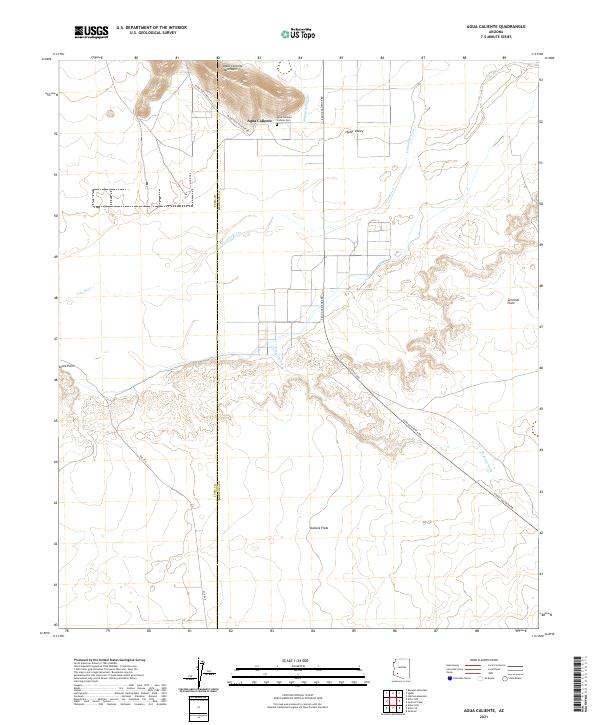
2021 Map of Agua Caliente
USGS Topo · Published 2021About this map
The Agua Caliente settlement and its nearby Agua Caliente Pioneer Cem anchor this section of the desert, where the border of Yuma County and Maricopa County divides a landscape defined by the winding path of the Gila River. This 2021 survey illustrates the complex drainage network of the Sonoran Desert, as seasonal waterways like Columbus Wash, Nottbusch Wash, and Sentinel Wash flow toward the river valley. The topography rises sharply from the Hyder Valley into the Agua Caliente Mountains, while the surrounding expanse is categorized by distinct geographic regions including Sentinel Plain, Stanwix Flats, and the landmark at Sears Point. Rural infrastructure is centered on the intersection of S Agua Caliente Rd and W Old Agua Caliente Rd, providing a detailed view of the modern road network and property divisions in this isolated corner of Arizona.
Find a feature on this map
21 named features on this map. Tap any name to fly to it.
Don’t see what you’re looking for? This feature index may not catch every label — zoom into the map to look around manually.
Map Details
Editions of this 2021 Agua Caliente Map
This is the sole edition of this map. No revisions or reprints were ever made.
Other maps of this area

1927 · Hyder
USGS Topo · 1:62,500

1929 · Aztec
USGS Topo · 1:62,500

1930 · Hyder
USGS Topo · 1:62,500

1942 · Vicksburg
USGS Topo · 1:250,000

1949 · Sentinel
USGS Topo · 1:62,500

1950 · Sentinel
USGS Topo · 1:62,500

1950 · Aztec
USGS Topo · 1:62,500

1951 · Dendora Valley
USGS Topo · 1:62,500

1953 · Ajo
USGS Topo · 1:250,000

1954 · Phoenix
USGS Topo · 1:250,000