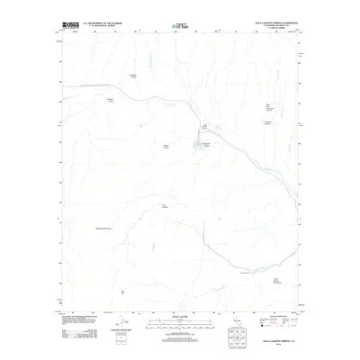
2012 Map of Agua Caliente Springs
USGS Topo · Published 2012About this map
The Great Southern Overland Stage Route of 1849 carves a historical path through this desert corridor, following the natural passage of Vallecito Creek across the Vallecito Valley. This 2012 survey illustrates a landscape defined by sharp elevation shifts between the Sawtooth Mountains and the Tierra Blanca Mountains. The presence of the Agua Caliente Airport and nearby Agua Caliente Springs marks a rare point of modern utility and oasis in an otherwise arid expanse of deep washes and canyons.
Find a feature on this map
21 named features on this map. Tap any name to fly to it.
Don’t see what you’re looking for? This feature index may not catch every label — zoom into the map to look around manually.
Map Details
Editions of this 2012 Agua Caliente Springs Map
This is the sole edition of this map. No revisions or reprints were ever made.
Other maps of this area

1931 · Vallecito
USGS Topo · 1:125,000

1931 · Carrizo
USGS Topo · 1:125,000

1939 · Borrego
USGS Topo · 1:62,500

1942 · Barrel Spring
USGS Topo · 1:62,500

1942 · Borego
USGS Topo · 1:62,500

1942 · Carrizo Mtn
USGS Topo · 1:62,500

1942 · Cuyapaipe
USGS Topo · 1:62,500

1943 · Vallecito
USGS Topo · 1:125,000

1947 · Santa Ana
USGS Topo · 1:250,000
1947 · Barrel Spring
USGS Topo · 1:62,500