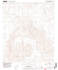
1997 Map of Agua Caliente Springs
USGS Topo · Published 2003About this map
Vallecito Stage Station County Park marks a significant historical corridor where the Old Overland Stage Route once provided a vital link through the desert. This landscape, dominated by the Tierra Blanca Mountains and the Sawtooth Range, preserves the traces of early California transportation history. The presence of the Vallecito-Sweeney Pass Old Overland Stage Road near Agua Caliente Springs illustrates how travel was dictated by the location of critical water sources like Seeps and the Waterhole.
Find a feature on this map
36 named features on this map. Tap any name to fly to it.
Don’t see what you’re looking for? This feature index may not catch every label — zoom into the map to look around manually.
Map Details
Editions of this 1997 Agua Caliente Springs Map
This is the sole edition of this map. No revisions or reprints were ever made.
Other maps of this area

1931 · Vallecito
USGS Topo · 1:125,000

1931 · Carrizo
USGS Topo · 1:125,000

1939 · Borrego
USGS Topo · 1:62,500

1942 · Barrel Spring
USGS Topo · 1:62,500

1942 · Borego
USGS Topo · 1:62,500

1942 · Carrizo Mtn
USGS Topo · 1:62,500

1942 · Cuyapaipe
USGS Topo · 1:62,500

1943 · Vallecito
USGS Topo · 1:125,000

1947 · Santa Ana
USGS Topo · 1:250,000
1947 · Barrel Spring
USGS Topo · 1:62,500