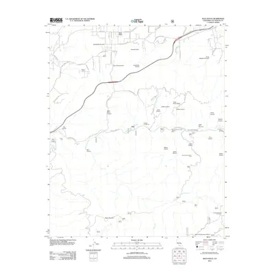
2012 Map of Agua Dulce
USGS Topo · Published 2012About this map
Agua Dulce and the surrounding high desert canyon country of Los Angeles County appear in this 2012 survey, revealing a landscape where residential expansion meets protected natural features. The prominent Vasquez Rocks stand north of the Santa Clara River, a terrain famously shaped by the San Andreas Fault system and long utilized by the film industry. The settlement of Russ and several specialized sites like County Detention Camp Number One and the Golden Spike Monument are situated along the Soledad Canyon Rd corridor. This transport-heavy landscape is further defined by the Sierra Pelona Valley and numerous named canyons, including Bee Canyon and Indian Canyon, reflecting the area's transition from ranching outposts like Nelson Ranch to modern recreational and residential use near Magic Mountain.
Find a feature on this map
78 named features on this map. Tap any name to fly to it.
Don’t see what you’re looking for? This feature index may not catch every label — zoom into the map to look around manually.
Map Details
Editions of this 2012 Agua Dulce Map
This is the sole edition of this map. No revisions or reprints were ever made.
Other maps of this area

1900 · Tujunga
USGS Topo · 1:62,500

1900 · Fernando
USGS Topo · 1:62,500

1901 · Southern California Sheet No. 1
USGS Topo · 1:250,000

1904 · Southern California Sheet No. 1
USGS Topo · 1:250,000

1915 · Elizabeth Lake
USGS Topo · 1:125,000

1917 · Elizabeth Lake
USGS Topo · 1:125,000

1929 · Lang
USGS Topo · 1:24,000

1930 · Ravenna
USGS Topo · 1:24,000

1932 · Red Rover
USGS Topo · 1:24,000
1932 · Mint Canyon
USGS Topo · 1:24,000