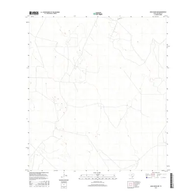
2016 Map of Agua Nueva NW
USGS Topo · Published 2016About this map
Jim Hogg County terrain transitions through this portion of South Texas, characterized by a complex network of private ranch roads and varying elevations. The landscape is primarily defined by its drainage patterns and the presence of La Lumbrita Rd, which traverses the northern section of the quadrangle. This 2016 survey by the U.S. Geological Survey provides a detailed view of the rural infrastructure and land divisions in a region dominated by large property holdings, where topographical contours reveal the subtle rises and depressions typical of the sandy plains north of the Rio Grande Valley.
Find a feature on this map
1 named feature on this map. Tap any name to fly to it.
Don’t see what you’re looking for? This feature index may not catch every label — zoom into the map to look around manually.
Map Details
Editions of this 2016 Agua Nueva NW Map
This is the sole edition of this map. No revisions or reprints were ever made.
Other maps of this area

1938 · Agua Nueva
USGS Topo · 1:62,500

1938 · Cuevitas
USGS Topo · 1:62,500

1939 · Randado
USGS Topo · 1:62,500

1940 · Randado
USGS Topo · 1:62,500

1949 · Mc Allen
USGS Topo · 1:250,000

1954 · McAllen
USGS Topo · 1:250,000

1956 · Laredo
USGS Topo · 1:250,000

1957 · Mc Allen
USGS Topo · 1:250,000

1962 · McAllen
USGS Topo · 1:250,000
1972 · San Pablo Ranch
USGS Topo · 1:24,000