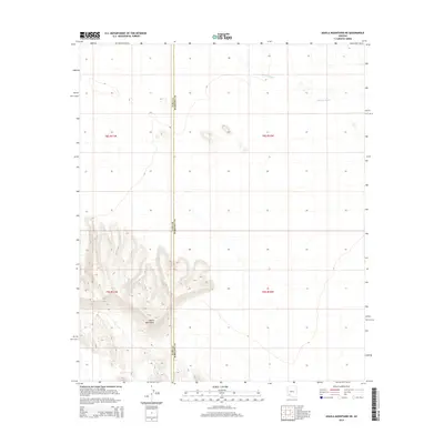
2014 Map of Aguila Mountains NE
USGS Topo · Published 2014About this map
The Aguila Mountains anchor the southwestern portion of this 2014 survey, rising sharply from the desert floor on the border of Maricopa and Yuma counties. This arid landscape is defined by its drainage patterns, most notably the braided course of Tenmile Wash which cuts across the northern flats. A critical water resource in this environment is the Natural Tank, situated within the mountain complex itself. The map captures a moment in the early 21st century when this corner of the Sonoran Desert remained largely undeveloped, characterized by public lands and a network of ephemeral watercourses rather than permanent settlements or industrial sites.
Find a feature on this map
8 named features on this map. Tap any name to fly to it.
Don’t see what you’re looking for? This feature index may not catch every label — zoom into the map to look around manually.
Map Details
Editions of this 2014 Aguila Mountains NE Map
This is the sole edition of this map. No revisions or reprints were ever made.
Other maps of this area

1927 · Aguila Mountains
USGS Topo · 1:48,000

1929 · Aztec
USGS Topo · 1:62,500

1930 · Aguila Mountains
USGS Topo · 1:62,500

1949 · Sentinel
USGS Topo · 1:62,500

1950 · Sentinel
USGS Topo · 1:62,500

1950 · Aztec
USGS Topo · 1:62,500

1953 · Ajo
USGS Topo · 1:250,000

1957 · Ajo
USGS Topo · 1:250,000

1958 · Ajo
USGS Topo · 1:250,000

1962 · Ajo
USGS Topo · 1:250,000