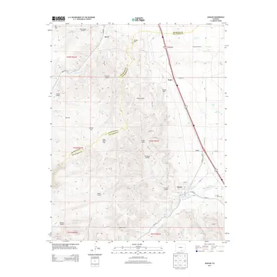
2013 Map of Aguilar
USGS Topo · Published 2013About this map
Aguilar sits at the base of a complex canyon system where the Apishapa River and Borrego Ditch provide vital water to this semi-arid landscape. The town is flanked by a series of high flats and named canyons, including Rugby Canyon and Brodhead Canyon, illustrating the varied topography of Las Animas County. To the north and south, small settlements like Rouse and Lynn follow the primary transportation corridor, while the Saint Anthony Cem east of town serves as a significant landmark for local genealogy. The map captures an environment where water management is paramount, evidenced by Poma Reservoir and the Homestead Windmill. Geologic and agricultural features such as Rugby Rock and Goat Ranch Flat further define the land use patterns that have sustained these communities into the early 21st century.
Find a feature on this map
57 named features on this map. Tap any name to fly to it.
Don’t see what you’re looking for? This feature index may not catch every label — zoom into the map to look around manually.
Map Details
Editions of this 2013 Aguilar Map
This is the sole edition of this map. No revisions or reprints were ever made.
Other maps of this area

1891 · Walsenburg
USGS Topo · 1:125,000

1891 · Spanish Peaks
USGS Topo · 1:125,000

1893 · Spanish Peaks
USGS Topo · 1:125,000

1894 · Walsenburg
USGS Topo · 1:125,000

1895 · Spanish Peaks
USGS Topo · 1:125,000

1897 · Walsenburg
USGS Topo · 1:125,000

1897 · Spanish Peaks
USGS Topo · 1:125,000

1900 · Spanish Peaks
USGS Topo · 1:125,000

1900 · Walsenburg
USGS Topo · 1:125,000

1954 · Trinidad
USGS Topo · 1:250,000