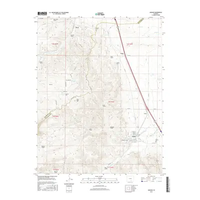
2016 Map of Aguilar
USGS Topo · Published 2016About this map
Aguilar sits at the base of the foothills where the plains meet the front range of the Rockies, anchoring this study of southern Colorado's landscape. The settlement patterns follow the drainages and historic transport corridors, with Lynn and Rugby positioned along the primary north-south highway and rail route. The eastern portion of the map is defined by the Apishapa River and the agricultural infrastructure of the Borrego Ditch, while the western terrain rises into a complex network of canyons and flats, including Black Hawk Canyon and Goat Ranch Flat. This area preserves a history of extraction and industry, evidenced by the Kirkland Pit and the presence of named roads like Rugby Mine Rd and Lower Mine Rd, which point to the region's mining heritage. Local genealogy is well-represented by Saint Anthony Cem located just east of the main town site. High points such as Rugby Rock and Bunker Hill provide distinct landmarks across the changing elevations.
Find a feature on this map
70 named features on this map. Tap any name to fly to it.
Don’t see what you’re looking for? This feature index may not catch every label — zoom into the map to look around manually.
Map Details
Editions of this 2016 Aguilar Map
This is the sole edition of this map. No revisions or reprints were ever made.
Other maps of this area

1891 · Walsenburg
USGS Topo · 1:125,000

1891 · Spanish Peaks
USGS Topo · 1:125,000

1893 · Spanish Peaks
USGS Topo · 1:125,000

1894 · Walsenburg
USGS Topo · 1:125,000

1895 · Spanish Peaks
USGS Topo · 1:125,000

1897 · Walsenburg
USGS Topo · 1:125,000

1897 · Spanish Peaks
USGS Topo · 1:125,000

1900 · Spanish Peaks
USGS Topo · 1:125,000

1900 · Walsenburg
USGS Topo · 1:125,000

1954 · Trinidad
USGS Topo · 1:250,000