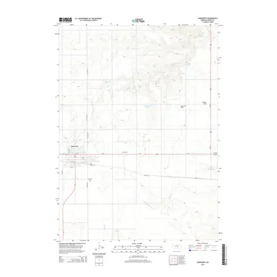
2014 Map of Ainsworth
USGS Topo · Published 2014About this map
Ainsworth serves as the focal point of this 2014 survey, situated where Us-20 and Ne-7 intersect in northern Nebraska. The town's layout is clearly defined by its residential grid, featuring streets like N Wilson St and W S St, while local history is anchored by the Ainsworth Cem south of town and Park Cem to the east. The surrounding landscape transition is evident between the flat expanse of Ainsworth Table and the drainage systems of Bone Cr and Willow Cr. A significant cultural feature is the Cowboy Trl, a recreational path following an old rail corridor that cuts across the southern portion of the map. This era shows the continued importance of the road network, including the legacy of Old Highway 7 and the route of Meadville Rd heading north toward the rugged breaks beyond the tableland.
Find a feature on this map
21 named features on this map. Tap any name to fly to it.
Don’t see what you’re looking for? This feature index may not catch every label — zoom into the map to look around manually.
Map Details
Editions of this 2014 Ainsworth Map
This is the sole edition of this map. No revisions or reprints were ever made.
Other maps of this area

1949 · Dutch Creek
USGS Topo · 1:24,000

1950 · Bassett NW
USGS Topo · 1:24,000

1950 · Dutch Creek
USGS Topo · 1:24,000

1954 · Ainsworth NW
USGS Topo · 1:24,000

1954 · Ainsworth SW
USGS Topo · 1:24,000

1954 · Ainsworth
USGS Topo · 1:24,000

1954 · Long Pine
USGS Topo · 1:24,000

1955 · O'Neill
USGS Topo · 1:250,000

1959 · O'Neill
USGS Topo · 1:250,000

1969 · O'Neill
USGS Topo · 1:250,000