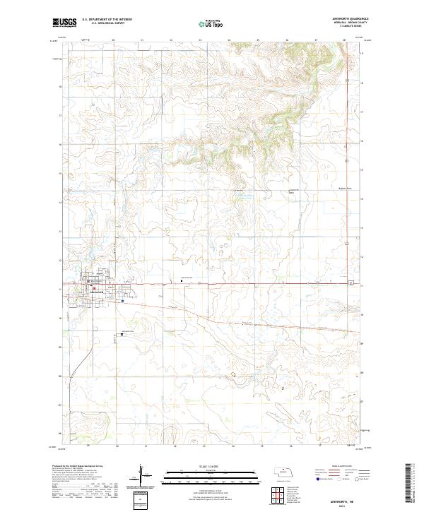
2021 Map of Ainsworth
USGS Topo · Published 2021About this map
The Brown County Courthouse stands as the central landmark in Ainsworth, Nebraska, a city that serves as a vital anchor in the Nebraska Sandhills region. This modern topographic study shows the town's grid and its transition into the high plains landscape of Ainsworth Table and Buffalo Flats. Significant local history and genealogy markers include the Ainsworth Cem to the south and East Park Cem to the east. The terrain is defined by the winding course of Bone Cr and the waters of Moody Group Reservoir, illustrating the essential relationship between the local hydrology and the surrounding prairie. Modern recreation and legacy transport intersect at the Cowboy Trl, a notable conversion of a former rail line into a long-distance trail. For researchers, the map provides precise locations for everything from municipal streets like N Osborne St to rural infrastructure like Cemetery Rd.
Find a feature on this map
31 named features on this map. Tap any name to fly to it.
Don’t see what you’re looking for? This feature index may not catch every label — zoom into the map to look around manually.
Map Details
Editions of this 2021 Ainsworth Map
This is the sole edition of this map. No revisions or reprints were ever made.
Other maps of this area

1949 · Dutch Creek
USGS Topo · 1:24,000

1950 · Bassett NW
USGS Topo · 1:24,000

1950 · Dutch Creek
USGS Topo · 1:24,000

1954 · Ainsworth NW
USGS Topo · 1:24,000

1954 · Ainsworth SW
USGS Topo · 1:24,000

1954 · Ainsworth
USGS Topo · 1:24,000

1954 · Long Pine
USGS Topo · 1:24,000

1955 · O'Neill
USGS Topo · 1:250,000

1959 · O'Neill
USGS Topo · 1:250,000

1969 · O'Neill
USGS Topo · 1:250,000