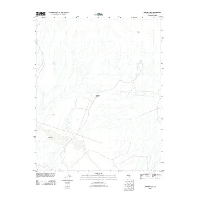
2012 Map of Airport Lake
USGS Topo · Published 2012About this map
Airport Lake defines the southern portion of this high desert landscape within the Coso Basin, a region characterized by its complex volcanic and geothermal signatures. To the north, the terrain rises sharply toward Volcano Butte, while the drainage of Coso Wash carves through the western reaches. This 2012 survey illustrates the remote character of Inyo County, where geological features like Black Canyon and Renegade Canyon dominate the topography. The map reveals a sparse network of roads that navigate the basin floor, reflecting the area's isolation and its utility for specialized aviation or research purposes centered around the lake bed. This document provides a clear view of the natural corridors and elevation changes that have dictated movement through this arid environment for decades.
Find a feature on this map
6 named features on this map. Tap any name to fly to it.
Don’t see what you’re looking for? This feature index may not catch every label — zoom into the map to look around manually.
Map Details
Editions of this 2012 Airport Lake Map
This is the sole edition of this map. No revisions or reprints were ever made.
Other maps of this area

1908 · Ballarat
USGS Topo · 1:250,000

1913 · Ballarat
USGS Topo · 1:250,000

1915 · Searles Lake
USGS Topo · 1:250,000

1947 · Trona
USGS Topo · 1:250,000

1948 · Trona
USGS Topo · 1:250,000

1948 · Death Valley
USGS Topo · 1:250,000

1951 · Haiwee Reservoir
USGS Topo · 1:62,500

1951 · Coso Peak
USGS Topo · 1:62,500

1953 · Mountain Springs Canyon
USGS Topo · 1:62,500

1953 · Trona
USGS Topo · 1:250,000