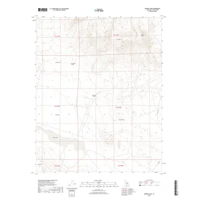
2018 Map of Airport Lake
USGS Topo · Published 2018About this map
Airport Lake and the surrounding high-desert terrain of Inyo County define this landscape at the intersection of the Coso Range and the northern reaches of the Mojave Desert. The map reveals a complex system of drainage and geological features, from the dramatic Black Canyon and Petroglyph Canyon in the north to the White Hills at the southern margin. The dry bed of Airport Lake sits within the Coso Basin, flanked by the seasonal Coso Wash. This area is characterized by significant topographical shifts, including the prominent Volcano Butte and the winding course of Renegade Canyon. Darwin Rd provides one of the few named transport links through this arid environment, which is marked by numerous ephemeral water features and the rugged contours of the eastern Sierra region.
Find a feature on this map
17 named features on this map. Tap any name to fly to it.
Don’t see what you’re looking for? This feature index may not catch every label — zoom into the map to look around manually.
Map Details
Editions of this 2018 Airport Lake Map
This is the sole edition of this map. No revisions or reprints were ever made.
Other maps of this area

1908 · Ballarat
USGS Topo · 1:250,000

1913 · Ballarat
USGS Topo · 1:250,000

1915 · Searles Lake
USGS Topo · 1:250,000

1947 · Trona
USGS Topo · 1:250,000

1948 · Trona
USGS Topo · 1:250,000

1948 · Death Valley
USGS Topo · 1:250,000

1951 · Haiwee Reservoir
USGS Topo · 1:62,500

1951 · Coso Peak
USGS Topo · 1:62,500

1953 · Mountain Springs Canyon
USGS Topo · 1:62,500

1953 · Trona
USGS Topo · 1:250,000