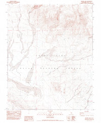
1982 Map of Airport Lake
USGS Topo · Published 1983About this map
The China Lake Naval Weapons Center dominates this high desert landscape, encompassing vast stretches of the Argus Range and Coso Basin. This 1982 provisional survey illustrates the intersection of military operations and dramatic geology, where the broad, flat reaches of Airport Lake and Dry Lake sit below steep-walled formations. Features such as Petroglyph Canyon and Renegade Canyon hint at the area's ancient human and geological history, while Volcano Butte and Wild Horse Mesa define the topographic relief. The map reveals the isolation of the territory, with only a solitary Mine and the ephemeral Coso Wash breaking the arid expanse. It provides a technical look at the restricted Coso Basin at a time when the region was primarily dedicated to weapons testing and research.
Find a feature on this map
9 named features on this map. Tap any name to fly to it.
Don’t see what you’re looking for? This feature index may not catch every label — zoom into the map to look around manually.
Map Details
Editions of this 1982 Airport Lake Map
This is the sole edition of this map. No revisions or reprints were ever made.
Other maps of this area

1908 · Ballarat
USGS Topo · 1:250,000

1913 · Ballarat
USGS Topo · 1:250,000

1915 · Searles Lake
USGS Topo · 1:250,000

1947 · Trona
USGS Topo · 1:250,000

1948 · Trona
USGS Topo · 1:250,000

1948 · Death Valley
USGS Topo · 1:250,000

1951 · Haiwee Reservoir
USGS Topo · 1:62,500

1951 · Coso Peak
USGS Topo · 1:62,500

1953 · Mountain Springs Canyon
USGS Topo · 1:62,500

1953 · Trona
USGS Topo · 1:250,000