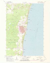
1966 Map of Alabaster
USGS Topo · Published 1978About this map
Industrial activity dominates this coastal landscape on Saginaw Bay, where the massive Strip Mine and its network of conveyor towers highlight the extraction of local gypsum. The settlement of Alabaster serves as the hub for these operations, connected to the interior by the Detroit and Mackinac railroad and a grid of rural roads like Gypsum Road. To the north and south, the shoreline is lined with residential developments including Huron Oaks, Hyde Park, and Harmon City Heights, contrasting the heavy industrial center with recreational and community spaces.
Find a feature on this map
51 named features on this map. Tap any name to fly to it.
Don’t see what you’re looking for? This feature index may not catch every label — zoom into the map to look around manually.
Map Details
Editions of this 1966 Alabaster Map
2 editions found
Other maps of this area

1954 · Tawas City
USGS Topo · 1:250,000

1958 · Tawas City
USGS Topo · 1:250,000

1959 · Tawas City
USGS Topo · 1:62,500

1959 · East Tawas
USGS Topo · 1:62,500

1966 · Point Lookout
USGS Topo · 1:24,000

1966 · Au Gres
USGS Topo · 1:24,000

1966 · Alabaster
USGS Topo · 1:24,000

1966 · National City
USGS Topo · 1:24,000
1970 · Charity Island
USGS Topo · 1:24,000

1984 · Tawas City
USGS Topo · 1:100,000