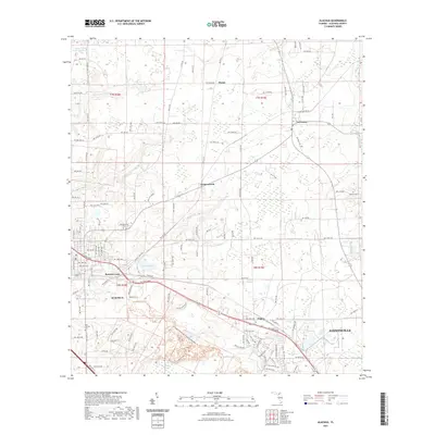
2021 Map of Alachua
USGS Topo · Published 2021About this map
Alachua and Gainesville sit at the southern edge of this modern survey, where the developing urban corridor meets the rural north-central Florida landscape. The terrain is defined by low-lying basins and limestone prairie systems, most notably the Sanchez Prairie and the marshlands surrounding Sweet Water Lake. A significant portion of the southwestern quadrant is preserved by the San Felasco Hammock Preserve State Park Trail, protecting a diverse ecological zone of sinkholes and hardwood hammocks.
Find a feature on this map
67 named features on this map. Tap any name to fly to it.
Don’t see what you’re looking for? This feature index may not catch every label — zoom into the map to look around manually.
Map Details
Editions of this 2021 Alachua Map
This is the sole edition of this map. No revisions or reprints were ever made.
Other maps of this area

1890 · Arredondo
USGS Topo · 1:62,500

1892 · Arredondo
USGS Topo · 1:62,500

1894 · Arredondo
USGS Topo · 1:62,500

1954 · Gainesville
USGS Topo · 1:250,000

1958 · Gainesville
USGS Topo · 1:250,000

1959 · Gainesville
USGS Topo · 1:250,000

1962 · High Springs
USGS Topo · 1:24,000

1962 · Mikesville
USGS Topo · 1:24,000
1966 · Worthington Springs
USGS Topo · 1:24,000

1966 · Gainesville West
USGS Topo · 1:24,000