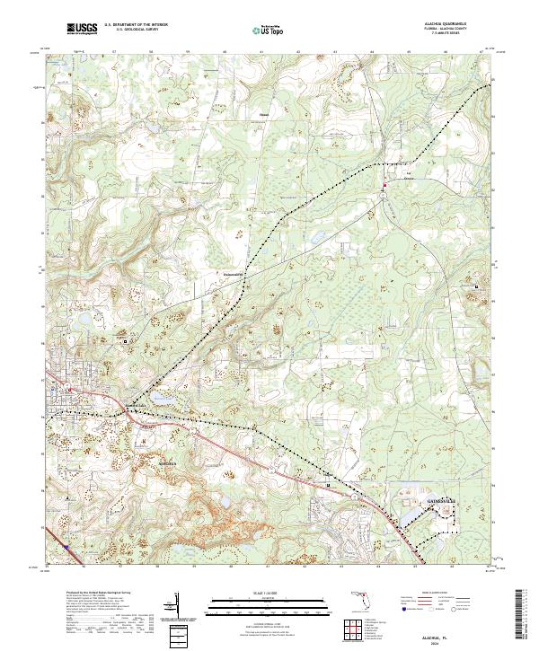
2024 Map of Alachua
USGS Topo · Published 2024About this map
Alachua and the northern outskirts of Gainesville center this detailed 2024 survey, which reveals a transition from concentrated settlements to the conservation lands of the San Felasco Hammock Preserve State Park. The landscape is defined by its karst-influenced hydrology, including Burnetts Lake, Sweet Water Lake, and the expansive Sanchez Prairie. The presence of several significant burial grounds, such as the Old Thomas Cem and Newmansville Cem, indicates the deep-rooted community history of this Alachua County region. Transportation networks, including the CSX Transportation line and historic thoroughfares like Old Bellamy Rd, illustrate the long-standing importance of this corridor for commerce and movement. Small rural clusters like Hasan, La Crosse, and Hague anchor the northern reaches of the quadrangle, maintaining their distinct identity amidst the modern growth of the surrounding area.
Find a feature on this map
68 named features on this map. Tap any name to fly to it.
Don’t see what you’re looking for? This feature index may not catch every label — zoom into the map to look around manually.
Map Details
Editions of this 2024 Alachua Map
This is the sole edition of this map. No revisions or reprints were ever made.
Other maps of this area

1890 · Arredondo
USGS Topo · 1:62,500

1892 · Arredondo
USGS Topo · 1:62,500

1894 · Arredondo
USGS Topo · 1:62,500

1954 · Gainesville
USGS Topo · 1:250,000

1958 · Gainesville
USGS Topo · 1:250,000

1959 · Gainesville
USGS Topo · 1:250,000

1962 · High Springs
USGS Topo · 1:24,000

1962 · Mikesville
USGS Topo · 1:24,000
1966 · Worthington Springs
USGS Topo · 1:24,000

1966 · Gainesville West
USGS Topo · 1:24,000