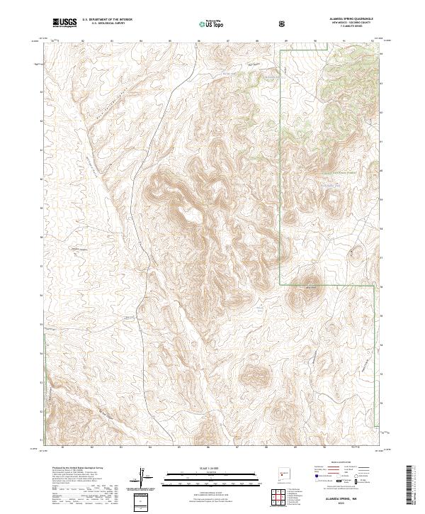
2023 Map of Alameda Spring
USGS Topo · Published 2023About this map
Alameda Spring serves as a central landmark in this high-desert landscape within the Cibola National Forest of Socorro County. The terrain is defined by a series of deep drainages and canyons, including Mill Canyon, Rock Springs Canyon, and Milligan Gulch, which illustrate the complex topography of the region. Local water management for livestock or wildlife is evident through named catchments like Barnet Tank, McDaniel Tank, and Rock-Header Tank.
Find a feature on this map
22 named features on this map. Tap any name to fly to it.
Don’t see what you’re looking for? This feature index may not catch every label — zoom into the map to look around manually.
Map Details
Editions of this 2023 Alameda Spring Map
This is the sole edition of this map. No revisions or reprints were ever made.
Other maps of this area

1954 · Tularosa
USGS Topo · 1:250,000

1954 · Socorro
USGS Topo · 1:250,000

1958 · Socorro
USGS Topo · 1:250,000

1958 · Tularosa
USGS Topo · 1:250,000

1959 · Magdalena
USGS Topo · 1:62,500

1962 · Socorro
USGS Topo · 1:250,000

1963 · Arroyo Landavaso
USGS Topo · 1:24,000
1964 · Grassy Lookout
USGS Topo · 1:24,000

1964 · Tres Montosas
USGS Topo · 1:24,000
1965 · Tenmile Hill
USGS Topo · 1:24,000