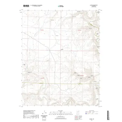
2020 Map of Alamito
USGS Topo · Published 2020About this map
The settlement of Alamito sits at a crossroads in the northeastern reaches of New Mexico, where the plains give way to a deeply carved drainage network. The Canadian River cuts through the northeast corner of the map, forming dramatic loops at Upper Horseshoe Bend and Lower Horseshoe Bend along the Harding and Mora County line. Further south, the Mora River winds through the landscape, joined by numerous tributary canyons that define the local geography. These canyons, such as Cañon Medina, Cañon Leon, and Cañon de David, highlight a topography dictated by seasonal water flow and erosion. The name School Section Canyon indicates historical land use patterns tied to the Public Land Survey System, while smaller water features like Pozo Azul and El Ojito point to the critical importance of localized springs and seeps in this arid environment.
Find a feature on this map
33 named features on this map. Tap any name to fly to it.
Don’t see what you’re looking for? This feature index may not catch every label — zoom into the map to look around manually.
Map Details
Editions of this 2020 Alamito Map
This is the sole edition of this map. No revisions or reprints were ever made.
Other maps of this area

1892 · Watrous
USGS Topo · 1:125,000

1894 · Watrous
USGS Topo · 1:125,000

1954 · Santa Fe
USGS Topo · 1:250,000

1958 · Santa Fe
USGS Topo · 1:250,000

1964 · Alamosa Creek
USGS Topo · 1:24,000

1964 · Canon Ancho
USGS Topo · 1:24,000

1971 · Beaver Canyon
USGS Topo · 1:24,000

1971 · Alamito
USGS Topo · 1:24,000

1971 · Canon Las Cuevas
USGS Topo · 1:24,000

1971 · Canon Encierro
USGS Topo · 1:24,000