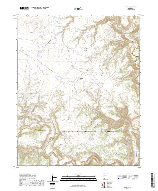
2023 Map of Alamito
USGS Topo · Published 2023About this map
Alamito sits at the center of a landscape defined by deep-cut drainage systems and high plateaus where the Mora River and Canadian River converge. This 2023 survey illustrates the complex topography of the region, featuring dramatic winding watercourses like Upper Horseshoe Bend and Lower Horseshoe Bend. The map documents a sparsely settled area where life and transport are dictated by the terrain, with State Hwy 271 providing the primary corridor through the hills. Numerous named canyons, such as Cañon Alamito and Cañon Oso, indicate a long history of local nomenclature for specific grazing and passage areas. The transition between Mora, Harding, and San Miguel counties occurs amidst these natural landmarks, highlighting the role of rivers and ridges in defining modern administrative boundaries.
Find a feature on this map
33 named features on this map. Tap any name to fly to it.
Don’t see what you’re looking for? This feature index may not catch every label — zoom into the map to look around manually.
Map Details
Editions of this 2023 Alamito Map
This is the sole edition of this map. No revisions or reprints were ever made.
Other maps of this area

1892 · Watrous
USGS Topo · 1:125,000

1894 · Watrous
USGS Topo · 1:125,000

1954 · Santa Fe
USGS Topo · 1:250,000

1958 · Santa Fe
USGS Topo · 1:250,000

1964 · Alamosa Creek
USGS Topo · 1:24,000

1964 · Canon Ancho
USGS Topo · 1:24,000

1971 · Beaver Canyon
USGS Topo · 1:24,000

1971 · Alamito
USGS Topo · 1:24,000

1971 · Canon Las Cuevas
USGS Topo · 1:24,000

1971 · Canon Encierro
USGS Topo · 1:24,000