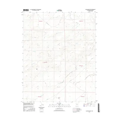
2017 Map of Alamo Mesa East
USGS Topo · Published 2017About this map
Alamo Mesa and the surrounding high desert of the San Juan Basin appear here in high detail, defined by a network of seasonal watercourses and remote plateaus. This corner of the Eastern Navajo Agency is characterized by the convergence of several major drainages, including Alamo Wash, Willow Wash, and De-na-zin Wash, which carve through the arid terrain. The presence of Ojo Alamo Spring marks a rare water source in this dry landscape, while the level expanse of Split Lip Flats contrasts with the mesa's elevation. Transportation in the region is limited to local routes such as Co Rd 7280 and Is Rt 7023, reflecting the area's sparse settlement and the preservation of its natural topography. The map documents the intricate contour lines of the badlands and washes, essential for understanding the hydrological patterns of this high-altitude desert environment.
Find a feature on this map
17 named features on this map. Tap any name to fly to it.
Don’t see what you’re looking for? This feature index may not catch every label — zoom into the map to look around manually.
Map Details
Editions of this 2017 Alamo Mesa East Map
This is the sole edition of this map. No revisions or reprints were ever made.
Other maps of this area

1889 · Largo
USGS Topo · 1:250,000

1889 · Chaco
USGS Topo · 1:250,000

1892 · Chaco
USGS Topo · 1:250,000

1895 · Largo
USGS Topo · 1:250,000

1954 · Shiprock
USGS Topo · 1:250,000

1954 · Aztec
USGS Topo · 1:250,000

1958 · Shiprock
USGS Topo · 1:250,000

1958 · Aztec
USGS Topo · 1:250,000

1959 · Shiprock
USGS Topo · 1:250,000

1962 · Aztec
USGS Topo · 1:250,000