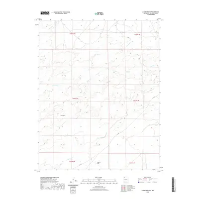
2020 Map of Alamo Mesa East
USGS Topo · Published 2020About this map
Alamo Mesa rises above a desert landscape defined by an intricate network of seasonal drainage channels in this San Juan County survey. The terrain transitions from the broad expanse of Split Lip Flats in the south to the dissected uplands near Ojo Alamo Spring. Water, though ephemeral, has clearly shaped the geography here, leaving behind the deep cuts of De-na-zin Wash, Alamo Wash, and Willow Wash. Unlike many Western maps defined by towns and railroads, this portion of the Eastern Navajo Agency is characterized by its open range and a sparse network of roads, including Is RT 7023 and Co RD 7280. The map captures the physical reality of the New Mexico high desert where land management and natural hydrology are the primary features of interest.
Find a feature on this map
17 named features on this map. Tap any name to fly to it.
Don’t see what you’re looking for? This feature index may not catch every label — zoom into the map to look around manually.
Map Details
Editions of this 2020 Alamo Mesa East Map
This is the sole edition of this map. No revisions or reprints were ever made.
Other maps of this area

1889 · Largo
USGS Topo · 1:250,000

1889 · Chaco
USGS Topo · 1:250,000

1892 · Chaco
USGS Topo · 1:250,000

1895 · Largo
USGS Topo · 1:250,000

1954 · Shiprock
USGS Topo · 1:250,000

1954 · Aztec
USGS Topo · 1:250,000

1958 · Shiprock
USGS Topo · 1:250,000

1958 · Aztec
USGS Topo · 1:250,000

1959 · Shiprock
USGS Topo · 1:250,000

1962 · Aztec
USGS Topo · 1:250,000