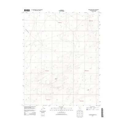
2013 Map of Alamo Mesa West
USGS Topo · Published 2013About this map
Bisti Badlands dominates the central portion of this high-desert landscape in San Juan County, revealing the complex erosion patterns and drainage networks that define the Eastern Navajo Agency. The topography is shaped by seasonal watercourses, including the long reach of Hunter Wash and the convergence of Willow Wash and Alamo Wash near the southern elevation of Alamo Mesa. Human presence is marked primarily by infrastructure designed for movement across the arid terrain, specifically Indian Service Route 5080 and Road 7250. This map provides a detailed look at the Public Land Survey System grid, illustrating the Township and Range boundaries such as t24n r13w and t24n r12w that organize this sprawling New Mexico territory.
Find a feature on this map
13 named features on this map. Tap any name to fly to it.
Don’t see what you’re looking for? This feature index may not catch every label — zoom into the map to look around manually.
Map Details
Editions of this 2013 Alamo Mesa West Map
This is the sole edition of this map. No revisions or reprints were ever made.
Other maps of this area

1889 · Chaco
USGS Topo · 1:250,000

1892 · Chaco
USGS Topo · 1:250,000

1927 · Sulphur Spring
USGS Topo · 1:96,000

1928 · Kirtland
USGS Topo · 1:125,000

1932 · Kirtland
USGS Topo · 1:125,000

1954 · Shiprock
USGS Topo · 1:250,000

1958 · Shiprock
USGS Topo · 1:250,000

1959 · Shiprock
USGS Topo · 1:250,000
1966 · Tanner Lake
USGS Topo · 1:24,000
1966 · Alamo Mesa East
USGS Topo · 1:24,000