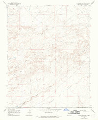
1966 Map of Alamo Mesa East
USGS Topo · Published 1969About this map
Alamo Mesa dominates this mid-1960s landscape, defined by a network of drainage systems including Hunter Wash and Willow Wash in the northern reaches. The area is characterized by the stark topography of Flats and the distinctively named Split Lip to the south. Human activity in this San Juan County region is sparse but evident through industrial and transit markers. A Pipeline cuts across the northeastern corner, and scattered Drill Holes suggest mineral or resource exploration during this era. Movement through the arid terrain relied on a minimal network of primitive routes, labeled as Jeep Trails and standard Trails, which navigate the complex breaks and washes like Alamo Wash and the winding De-na-zin Wash.
Find a feature on this map
15 named features on this map. Tap any name to fly to it.
Don’t see what you’re looking for? This feature index may not catch every label — zoom into the map to look around manually.
Map Details
Editions of this 1966 Alamo Mesa East Map
2 editions found
Other maps of this area

1889 · Largo
USGS Topo · 1:250,000

1889 · Chaco
USGS Topo · 1:250,000

1892 · Chaco
USGS Topo · 1:250,000

1895 · Largo
USGS Topo · 1:250,000

1954 · Shiprock
USGS Topo · 1:250,000

1954 · Aztec
USGS Topo · 1:250,000

1958 · Shiprock
USGS Topo · 1:250,000

1958 · Aztec
USGS Topo · 1:250,000

1959 · Shiprock
USGS Topo · 1:250,000

1962 · Aztec
USGS Topo · 1:250,000