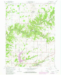
1961 Map of Alamo
USGS Topo · Published 1980About this map
Shades State Park and the deep winding cut of Sugar Creek dominate this landscape on the border of Fountain, Parke, and Montgomery Counties. The map reveals a transition in land use between the rugged natural formations like Pedestal Rock and Devils Backbone and the organized grid of rural roads and homesteads. Further south, the 1980 revisions highlight the development of Lake Waveland Park, a significant change to the local hydrology and recreation landscape near the town of Waveland. Local genealogists will find several burial sites and institutions of interest, including Stonebreaker Cem, Maple Ridge Cem, and Freedom Ch. The area around Alamo is documented through its network of county roads, such as Lutheran Church Road and Schoolhouse Road, which anchor the smaller crossroads communities of the early and mid-20th century.
Find a feature on this map
68 named features on this map. Tap any name to fly to it.
Don’t see what you’re looking for? This feature index may not catch every label — zoom into the map to look around manually.
Map Details
Editions of this 1961 Alamo Map
Other maps of this area

1948 · Wallace
USGS Topo · 1:24,000

1949 · Alamo
USGS Topo · 1:24,000

1953 · Danville
USGS Topo · 1:250,000

1953 · Indianapolis
USGS Topo · 1:250,000

1955 · Danville
USGS Topo · 1:250,000

1955 · Rockville
USGS Topo · 1:24,000

1955 · Russellville
USGS Topo · 1:24,000

1956 · Danville
USGS Topo · 1:250,000

1956 · Indianapolis
USGS Topo · 1:250,000

1956 · Crawfordsville
USGS Topo · 1:24,000