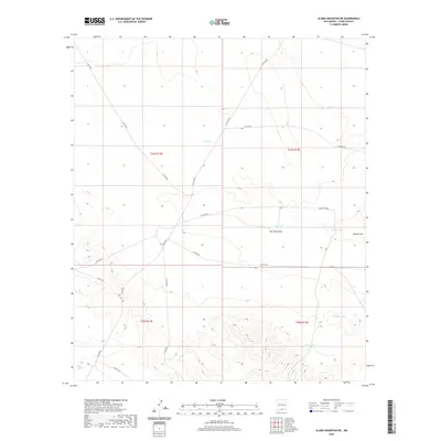
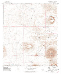
2020 Map of Alamo Mountain NE
USGS Topo · Published 2020About this map
Water management dominates this arid stretch of Otero County, where a system of ephemeral catchments and named tanks supports the desert landscape. Scattered throughout the townships of T24S R13E and T24S R14E, features such as Lake Tank, Zazu Tank, and New Tank indicate the vital importance of surface water collection in a region defined by seasonal drainage patterns. Natural depressions like Tulloch Lake and Cowan Lake are central landmarks, often serving as the primary destinations for the network of unimproved roads like Co RD f068 and Co RD f039 that crisscross the terrain. The presence of Shiloh Draw and New Tank Draw further illustrates the topographic reliance on intermittent runoff. This survey provides a clear look at the infrastructure of the American Southwest's grazing and ranching heritage, documented through the lens of early 21st-century mapping standards.
Find a feature on this map
23 named features on this map. Tap any name to fly to it.
Don’t see what you’re looking for? This feature index may not catch every label — zoom into the map to look around manually.
Map Details
Editions of this 2020 Alamo Mountain NE Map
This is the sole edition of this map. No revisions or reprints were ever made.
Other maps of this area

1954 · Carlsbad
USGS Topo · 1:250,000

1958 · Carlsbad
USGS Topo · 1:250,000

1959 · Alamo Mountain
USGS Topo · 1:62,500

1963 · Cleones Tank
USGS Topo · 1:24,000
1970 · Mc Veigh Hills
USGS Topo · 1:24,000

1970 · Shiloh Hills
USGS Topo · 1:24,000
1975 · Alamo Mountain
USGS Topo · 1:24,000

1975 · Alamo Mountain NE
USGS Topo · 1:24,000
1975 · B T Ranch
USGS Topo · 1:24,000
1975 · Cornudas Mountain
USGS Topo · 1:24,000