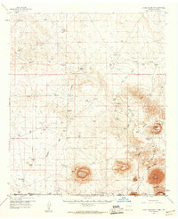
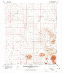
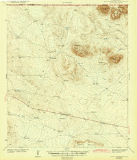
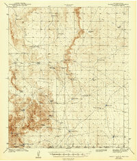
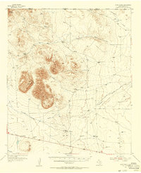
1959 Map of Alamo Mountain
USGS Topo · Published 1960About this map
The Cornudas Mountains define the arid landscape of this borderland survey, where the high desert of Otero County, New Mexico, meets Hudspeth County, Texas. Life in this environment at mid-century centered on isolated livestock operations and water management, evidenced by the numerous tanks scattered across the terrain, such as Potter Tank, Brownfield Tank, and Hackberry Tank. Large family holdings like Wimberly Ranch, Bennett Ranch, and Cornudas Ranch suggest a ranching economy reliant on wide grazing ranges and the precious flow from Alamo Spring. To the south, the peaks of Alamo Mountain, Wind Mountain, and Chatfield Mountain rise sharply from the basin floor. An Airstrip and several Oil Wells indicate the intrusion of modern industry and transportation into this remote corner of the Southwest, while drainage patterns like Shiloh Draw and Hackberry Draw trace the path of seasonal water across the high plains.
Find a feature on this map
78 named features on this map. Tap any name to fly to it.
Don’t see what you’re looking for? This feature index may not catch every label — zoom into the map to look around manually.
Map Details
Editions of this 1959 Alamo Mountain Map
2 editions found
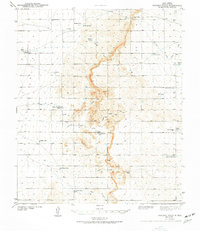
Other maps of this area

1903 · Cerro Alto
USGS Topo · 1:125,000

1940 · Bassett Lake
USGS Topo · 1:62,500
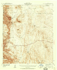
1941 · Heuco Mountains
USGS Topo · 1:62,500
1943 · Pendejo Wash
USGS Topo · 1:62,500
1943 · San Antonio Mtn
USGS Topo · 1:62,500

1943 · Heuco Mountains
USGS Topo · 1:62,500
1943 · Bassett Lake
USGS Topo · 1:62,500

1954 · Carlsbad
USGS Topo · 1:250,000

1954 · Van Horn
USGS Topo · 1:250,000
1955 · Cerro Diablo
USGS Topo · 1:62,500