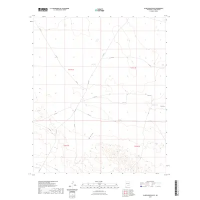
2023 Map of Alamo Mountain NE
USGS Topo · Published 2023About this map
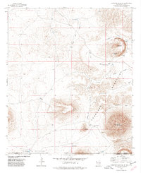
Ephemeral water sources and a network of county roads define this arid Otero County landscape. The distribution of water catchments such as Tulloch Lake, Lake Tank, and Rob Tanks reflects the essential infrastructure required for ranching and land management in the high desert. These features are often situated near natural drainage ways like Shiloh Draw and New Tank Draw, which channel seasonal runoff through the basin. The area is gridded by a series of primitive and secondary routes, including Co RD f001 and Co RD f026, providing access across several townships. This contemporary map captures the modern cadastral framework and surface hydrology of the region, emphasizing the importance of man-made storage features like Zazu Tank and Long Tank in an environment defined by its dry washes and sparse seasonal lakes.
Find a feature on this map
23 named features on this map. Tap any name to fly to it.
Don’t see what you’re looking for? This feature index may not catch every label — zoom into the map to look around manually.
Map Details
Editions of this 2023 Alamo Mountain NE Map
This is the sole edition of this map. No revisions or reprints were ever made.
Other maps of this area

1954 · Carlsbad
USGS Topo · 1:250,000

1958 · Carlsbad
USGS Topo · 1:250,000

1959 · Alamo Mountain
USGS Topo · 1:62,500

1963 · Cleones Tank
USGS Topo · 1:24,000
1970 · Mc Veigh Hills
USGS Topo · 1:24,000

1970 · Shiloh Hills
USGS Topo · 1:24,000
1975 · Alamo Mountain
USGS Topo · 1:24,000

1975 · Alamo Mountain NE
USGS Topo · 1:24,000
1975 · B T Ranch
USGS Topo · 1:24,000
1975 · Cornudas Mountain
USGS Topo · 1:24,000