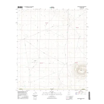
2017 Map of Alamo Mountain
USGS Topo · Published 2017About this map
Alamo Mountain dominates the southeastern corner of this high-desert landscape on the border of New Mexico and Texas. The terrain is defined by a critical network of water catchments essential for ranching and survival in this arid environment, including Alamo Tank, Grief Tank, and Copper Bottom Tank. These water sources are connected by a system of county roads and tracks like Co RD f001 and Co RD f007 that traverse the township boundaries of t25s r12e and t26s r13e. Near the base of the mountain, Alamo Spring provides a rare natural water source, while the northern reaches are drained by the winding Hackberry Draw. This survey captures a specialized landscape of resource management, where named tanks such as King Tank and Mixen Tank represent the vital infrastructure of the rural borderlands.
Find a feature on this map
31 named features on this map. Tap any name to fly to it.
Don’t see what you’re looking for? This feature index may not catch every label — zoom into the map to look around manually.
Map Details
Editions of this 2017 Alamo Mountain Map
This is the sole edition of this map. No revisions or reprints were ever made.
Other maps of this area

1903 · Cerro Alto
USGS Topo · 1:125,000

1940 · Bassett Lake
USGS Topo · 1:62,500

1941 · Heuco Mountains
USGS Topo · 1:62,500

1943 · San Antonio Mtn
USGS Topo · 1:62,500

1943 · Heuco Mountains
USGS Topo · 1:62,500

1943 · Bassett Lake
USGS Topo · 1:62,500

1954 · Carlsbad
USGS Topo · 1:250,000

1954 · Van Horn
USGS Topo · 1:250,000

1958 · Van Horn
USGS Topo · 1:250,000

1958 · Carlsbad
USGS Topo · 1:250,000