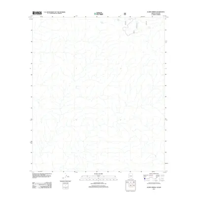
2012 Map of Alamo Spring
USGS Topo · Published 2012About this map
Alamo Spring serves as a critical water source in this arid borderland landscape along the Arizona-Sonora boundary. The terrain is defined by a complex network of ephemeral drainage channels that feed into various cattle tanks and reservoirs, such as Chiladote Tank and Coyote Tank. Human presence is primarily indicated by a system of numbered forest and ranch roads, including 4182 and 4189, which navigate the high-desert topography. The proximity to the international line is evidenced by the placement of Border Tank in the northern reach of the survey. This 2012 snapshot of the region highlights the essential infrastructure required for ranching and resource management in a remote environment where water features like Soto Tank are central to local land use.
Find a feature on this map
9 named features on this map. Tap any name to fly to it.
Don’t see what you’re looking for? This feature index may not catch every label — zoom into the map to look around manually.
Map Details
Editions of this 2012 Alamo Spring Map
This is the sole edition of this map. No revisions or reprints were ever made.
Other maps of this area

1921 · Old Glory
USGS Topo · 1:125,000

1942 · Ruby
USGS Topo · 1:62,500

1942 · Oro Blanco
USGS Topo · 1:62,500

1943 · Old Glory
USGS Topo · 1:125,000

1944 · Oro Blanco
USGS Topo · 1:62,500

1956 · Nogales
USGS Topo · 1:250,000
1957 · Ruby
USGS Topo · 1:62,500

1958 · Nogales
USGS Topo · 1:250,000

1959 · Nogales
USGS Topo · 1:250,000
1979 · Bartlett Mtn
USGS Topo · 1:24,000