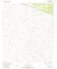
1980 Map of Alamo Spring
USGS Topo · Published 1980About this map
The international border between United States of America and Estados Unidos Mexicanos cuts diagonally across this 1980 survey, illustrating the high-elevation terrain where Arizona meets Sonora. Within the northern section, the Coronado National Forest covers the Pajarito Mountains, a region marked by vital water sources like Alamo Spring and various livestock tanks including Tonto Tank and Coyote Tank.
Find a feature on this map
64 named features on this map. Tap any name to fly to it.
Don’t see what you’re looking for? This feature index may not catch every label — zoom into the map to look around manually.
Map Details
Editions of this 1980 Alamo Spring Map
This is the sole edition of this map. No revisions or reprints were ever made.
Other maps of this area

1921 · Old Glory
USGS Topo · 1:125,000

1942 · Ruby
USGS Topo · 1:62,500

1942 · Oro Blanco
USGS Topo · 1:62,500

1943 · Old Glory
USGS Topo · 1:125,000

1944 · Oro Blanco
USGS Topo · 1:62,500

1956 · Nogales
USGS Topo · 1:250,000
1957 · Ruby
USGS Topo · 1:62,500

1958 · Nogales
USGS Topo · 1:250,000

1959 · Nogales
USGS Topo · 1:250,000
1979 · Bartlett Mtn
USGS Topo · 1:24,000