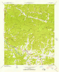
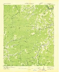
1940 Map of Alarka
USGS Topo · Published 1957About this map
Nantahala National Forest dominates this 1940 field examination, where the high ridges of the Cowee Mountains and Nantahala Mountains converge at the Swain and Macon County line. The Little Tennessee River snakes through the southern portion of the quadrangle, punctuated by Dean Island and structural crossings like Lost Bridge and McCoy Bridge. Small communities and family homesteads are concentrated in the creek bottoms, particularly along Alarka Creek and Cowee Creek.
Find a feature on this map
111 named features on this map. Tap any name to fly to it.
Don’t see what you’re looking for? This feature index may not catch every label — zoom into the map to look around manually.
Map Details
Editions of this 1940 Alarka Map
4 editions found
Other maps of this area

1891 · Cowee
USGS Topo · 1:125,000

1897 · Cowee
USGS Topo · 1:125,000

1907 · Cowee
USGS Topo · 1:125,000

1933 · Bryson
USGS Topo · 1:62,500

1933 · Bushnell
USGS Topo · 1:62,500

1935 · Franklin
USGS Topo · 1:24,000

1935 · Burningtown Bald
USGS Topo · 1:24,000

1935 · Wayah Bald
USGS Topo · 1:48,000

1935 · Corbin Knob
USGS Topo · 1:24,000
1936 · Greens Creek
USGS Topo · 1:24,000