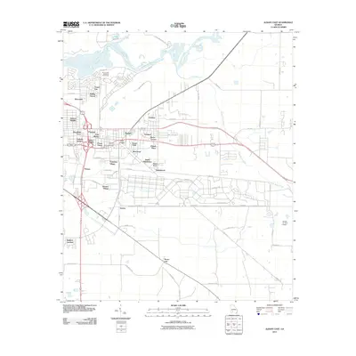
2011 Map of Albany East
USGS Topo · Published 2011About this map
Flint River flows along the northern edge of this Georgia landscape, providing a natural boundary for the residential expansion of eastern Albany during the early 21st century. The map reveals a dense network of neighborhoods and subdivisions, reflecting the area's mid-to-late 20th-century growth patterns. From the established blocks of East Albany and Jackson Heights to more spread-out developments like Avert Acres and Sandalwood, the geography is defined by suburban infill and a heavy reliance on the regional road system.
Find a feature on this map
67 named features on this map. Tap any name to fly to it.
Don’t see what you’re looking for? This feature index may not catch every label — zoom into the map to look around manually.
Map Details
Editions of this 2011 Albany East Map
This is the sole edition of this map. No revisions or reprints were ever made.
Other maps of this area

1953 · Dothan
USGS Topo · 1:250,000

1953 · Waycross
USGS Topo · 1:250,000

1954 · Dothan
USGS Topo · 1:250,000

1955 · Dothan
USGS Topo · 1:250,000

1956 · Albany East
USGS Topo · 1:24,000

1956 · Albany West
USGS Topo · 1:24,000

1956 · Baconton
USGS Topo · 1:62,500

1956 · Sylvester
USGS Topo · 1:62,500

1956 · Doerun
USGS Topo · 1:62,500

1956 · Albany
USGS Topo · 1:62,500