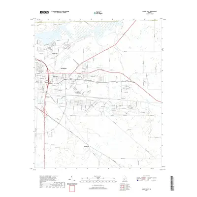
2020 Map of Albany East
USGS Topo · Published 2020About this map
The Albany eastern metropolitan area is defined by the winding course of the Flint River, which forms the northern boundary of the city and serves as a natural divide between residential neighborhoods and the river's wetland margins. This 2020 survey illustrates the expansion of suburban developments such as the Butler Subdivision and the established communities of East Albany and Five Points. Further north, Turner City sits near the river's edge, while Pecan City anchors the southern agricultural and residential interface. The map documents a complex network of local roads including Cromartie Beach Dr and Old Flowing Well Rd, highlighting the infrastructure supporting this regional hub in Dougherty County. Tributaries like Piney Woods Cr snake through the eastern landscape, influencing the placement of housing and the local drainage patterns.
Find a feature on this map
171 named features on this map. Tap any name to fly to it.
Don’t see what you’re looking for? This feature index may not catch every label — zoom into the map to look around manually.
Map Details
Editions of this 2020 Albany East Map
This is the sole edition of this map. No revisions or reprints were ever made.
Other maps of this area

1953 · Dothan
USGS Topo · 1:250,000

1953 · Waycross
USGS Topo · 1:250,000

1954 · Dothan
USGS Topo · 1:250,000

1955 · Dothan
USGS Topo · 1:250,000

1956 · Albany East
USGS Topo · 1:24,000

1956 · Albany West
USGS Topo · 1:24,000

1956 · Baconton
USGS Topo · 1:62,500

1956 · Sylvester
USGS Topo · 1:62,500

1956 · Doerun
USGS Topo · 1:62,500

1956 · Albany
USGS Topo · 1:62,500