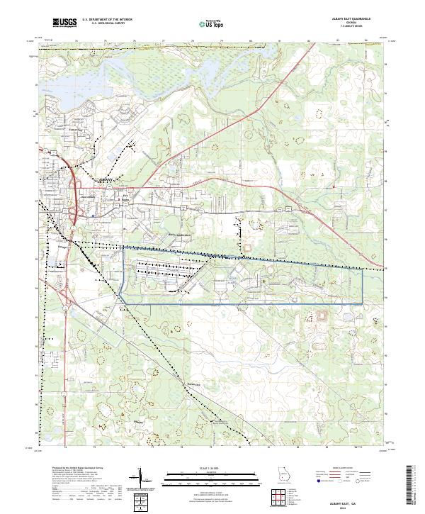
2024 Map of Albany East
USGS Topo · Published 2024About this map
The Flint River defines the western reaches of this Dougherty County landscape, carving a path past Turner City and the expanding residential corridors of East Albany. This modern geographic portrait reveals a complex mix of urban density and military infrastructure, anchored by the expansive MCLB Albany facility which dominates the central plains. To the south, the transition into more rural patterns is marked by the presence of Pecan City and Putney, areas where agricultural history meets contemporary settlement.
Find a feature on this map
176 named features on this map. Tap any name to fly to it.
Don’t see what you’re looking for? This feature index may not catch every label — zoom into the map to look around manually.
Map Details
Editions of this 2024 Albany East Map
This is the sole edition of this map. No revisions or reprints were ever made.
Other maps of this area

1953 · Dothan
USGS Topo · 1:250,000

1953 · Waycross
USGS Topo · 1:250,000

1954 · Dothan
USGS Topo · 1:250,000

1955 · Dothan
USGS Topo · 1:250,000

1956 · Albany East
USGS Topo · 1:24,000

1956 · Albany West
USGS Topo · 1:24,000

1956 · Baconton
USGS Topo · 1:62,500

1956 · Sylvester
USGS Topo · 1:62,500

1956 · Doerun
USGS Topo · 1:62,500

1956 · Albany
USGS Topo · 1:62,500