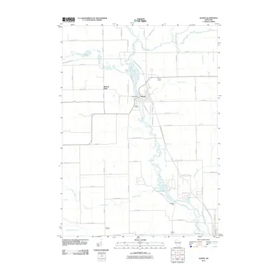
2010 Map of Albany
USGS Topo · Published 2010About this map
Albany sits as the central hub of this Green County landscape, where the Sugar River and the Little Sugar River converge. The waterway is punctuated by the Albany Dam near the town center and the Brodhead Dam further downstream on Decatur Lake, reflecting the region's historical reliance on river power. This 2010 survey illustrates a mix of agricultural land and recreational corridors, notably the Sugar River State Trl, which follows the path of a former rail line through the river valley. For those researching local family history, several burial grounds are documented, including Hillcrest Cemetery near the village and the more isolated Moores Cemetery to the southwest. The presence of Mineral Point and family-named roads like Dunphy Rd and Peebles Rd points to long-standing rural settlements and early land ownership patterns that have persisted into the 21st century.
Find a feature on this map
57 named features on this map. Tap any name to fly to it.
Don’t see what you’re looking for? This feature index may not catch every label — zoom into the map to look around manually.
Map Details
Editions of this 2010 Albany Map
This is the sole edition of this map. No revisions or reprints were ever made.
Other maps of this area

1889 · Evansville
USGS Topo · 1:62,500

1893 · Brodhead
USGS Topo · 1:62,500

1894 · Evansville
USGS Topo · 1:62,500

1906 · Evansville
USGS Topo · 1:62,500

1920 · Monroe
USGS Topo · 1:62,500

1922 · Monroe
USGS Topo · 1:62,500

1923 · New Glarus
USGS Topo · 1:62,500

1954 · Rockford
USGS Topo · 1:250,000

1955 · Rockford
USGS Topo · 1:250,000

1958 · Rockford
USGS Topo · 1:250,000