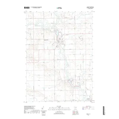
2018 Map of Albany
USGS Topo · Published 2018About this map
Albany and the northern outskirts of Brodhead anchor this landscape, where the Sugar River and its many tributaries, including Little Sugar River and Marsh Cr, create a complex network of wetlands and waterways. The map highlights the intersection of modern recreation and local heritage, featuring the Ice Age National Scenic Trail as it winds through the river valley north of town. Local history is preserved in sites like Hillcrest Cem near the village center and more rural burial grounds such as Moores Cem and Decatur Cem. The land use shows a mix of aviation at the Albany Airport and the persistent agricultural grid defined by roads like Co HWY Ee and Decatur Rd. The presence of Mineral Point and numerous small creeks like Norwegian Cr illustrates the well-watered character of Green County's rolling geography.
Find a feature on this map
80 named features on this map. Tap any name to fly to it.
Don’t see what you’re looking for? This feature index may not catch every label — zoom into the map to look around manually.
Map Details
Editions of this 2018 Albany Map
This is the sole edition of this map. No revisions or reprints were ever made.
Other maps of this area

1889 · Evansville
USGS Topo · 1:62,500

1893 · Brodhead
USGS Topo · 1:62,500

1894 · Evansville
USGS Topo · 1:62,500

1906 · Evansville
USGS Topo · 1:62,500

1920 · Monroe
USGS Topo · 1:62,500

1922 · Monroe
USGS Topo · 1:62,500

1923 · New Glarus
USGS Topo · 1:62,500

1954 · Rockford
USGS Topo · 1:250,000

1955 · Rockford
USGS Topo · 1:250,000

1958 · Rockford
USGS Topo · 1:250,000