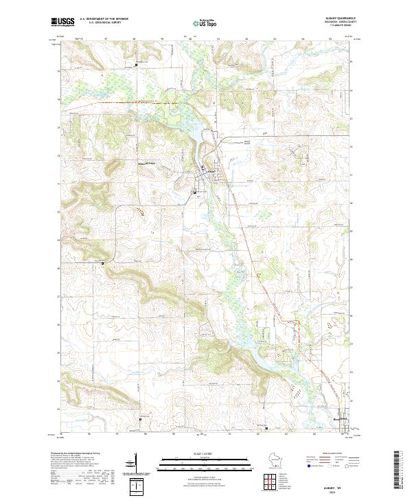
2022 Map of Albany
USGS Topo · Published 2022About this map
The Sugar River valley serves as the central artery for this region of Green County, dictating the placement of settlements and transport corridors. The village of Albany sits at a bend in the river, where the Sugar River State Trl and the Ice Age National Scenic Trl converge. This intersection of recreational trails reflects the modern reuse of historical transport paths through the driftless-edge landscape. To the south, the city of Brodhead marks the lower edge of the sheet, while smaller locales like Mineral Point and the gap at The Gap punctuate the surrounding agricultural uplands.
Find a feature on this map
82 named features on this map. Tap any name to fly to it.
Don’t see what you’re looking for? This feature index may not catch every label — zoom into the map to look around manually.
Map Details
Editions of this 2022 Albany Map
This is the sole edition of this map. No revisions or reprints were ever made.
Other maps of this area

1889 · Evansville
USGS Topo · 1:62,500

1893 · Brodhead
USGS Topo · 1:62,500

1894 · Evansville
USGS Topo · 1:62,500

1906 · Evansville
USGS Topo · 1:62,500

1920 · Monroe
USGS Topo · 1:62,500

1922 · Monroe
USGS Topo · 1:62,500

1923 · New Glarus
USGS Topo · 1:62,500

1954 · Rockford
USGS Topo · 1:250,000

1955 · Rockford
USGS Topo · 1:250,000

1958 · Rockford
USGS Topo · 1:250,000