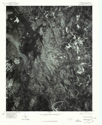
1977 Map of Albemarle NE
USGS Topo · Published 1979About this map
The Uwharrie Mountains dominate this 1977 orthophotograph, providing a rare visual record of the land surface as it appeared in the late seventies. This aerial perspective highlights the complex shoreline of Badin Lake and the confluence of the Yadkin River and Uwharrie River. Settlement patterns are clearly visible in the small communities of Eldorado and Blaine, while the industrial and residential footprint of Badin sits along the western edge of the water. Unlike traditional line maps, this imagery captures the exact density of forest cover and the extent of agricultural clearings surrounding Beaverdam Creek, offering researchers a literal view of the landscape before decades of subsequent growth and change in Montgomery County.
Find a feature on this map
8 named features on this map. Tap any name to fly to it.
Don’t see what you’re looking for? This feature index may not catch every label — zoom into the map to look around manually.
Map Details
Editions of this 1977 Albemarle NE Map
This is the sole edition of this map. No revisions or reprints were ever made.
Other maps of this area

1942 · Troy
USGS Topo · 1:125,000

1949 · High Rock
USGS Topo · 1:24,000

1953 · Raleigh
USGS Topo · 1:250,000

1953 · Charlotte
USGS Topo · 1:250,000

1954 · Charlotte
USGS Topo · 1:250,000

1954 · Raleigh
USGS Topo · 1:250,000

1957 · Albemarle
USGS Topo · 1:62,500

1957 · Denton
USGS Topo · 1:62,500

1957 · Troy
USGS Topo · 1:62,500

1957 · Asheboro
USGS Topo · 1:62,500