
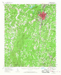
1957 Map of Asheboro
USGS Topo · Published 1959About this map
The town of Asheboro serves as the central hub of this mid-century survey, showing the community just as a new bypass is marked as under construction to the west. The landscape is defined by the peaks of the Uwharrie Mountains, including Caraway Mountain and Back Creek Mountain, which overlook a network of small agricultural and industrial settlements. To the south, the village of Whynot and the pottery center of Seagrove are connected by the Norfolk Southern railroad, illustrating the rural economy of Randolph County.
Find a feature on this map
116 named features on this map. Tap any name to fly to it.
Don’t see what you’re looking for? This feature index may not catch every label — zoom into the map to look around manually.
Map Details
Editions of this 1957 Asheboro Map
2 editions found
Other maps of this area

1942 · Troy
USGS Topo · 1:125,000

1951 · Fair Grove
USGS Topo · 1:24,000

1953 · Raleigh
USGS Topo · 1:250,000

1953 · Charlotte
USGS Topo · 1:250,000

1954 · Charlotte
USGS Topo · 1:250,000

1954 · Raleigh
USGS Topo · 1:250,000

1957 · Albemarle
USGS Topo · 1:62,500

1957 · Denton
USGS Topo · 1:62,500

1957 · Troy
USGS Topo · 1:62,500

1960 · Charlotte
USGS Topo · 1:250,000