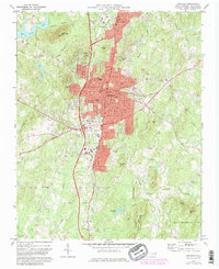
1970 Map of Asheboro
USGS Topo · Published 1982About this map
Asheboro serves as the central hub of this Piedmont landscape, appearing during a period of significant municipal growth as evidenced by the expansion of residential tracts near Dogwood Acres and North Asheboro. The urban core is defined by a dense grid of streets including Sunset Ave and Dixie Drive, housing essential civic infrastructure like Randolph Technical Institute and the McCrary Sch. This 1970s survey, updated in the early 1980s, captures the transition of the region's economy as the Southern and Norfolk Southern rail lines cross the terrain.
Find a feature on this map
69 named features on this map. Tap any name to fly to it.
Don’t see what you’re looking for? This feature index may not catch every label — zoom into the map to look around manually.
Map Details
Editions of this 1970 Asheboro Map
2 editions found
Other maps of this area

1953 · Raleigh
USGS Topo · 1:250,000

1954 · Raleigh
USGS Topo · 1:250,000

1957 · Asheboro
USGS Topo · 1:62,500

1968 · Ramseur
USGS Topo · 1:24,000

1968 · Erect
USGS Topo · 1:24,000

1970 · Randleman
USGS Topo · 1:24,000
1970 · Glenola
USGS Topo · 1:24,000

1970 · Asheboro
USGS Topo · 1:24,000
1973 · Eleazer
USGS Topo · 1:24,000

1973 · Seagrove
USGS Topo · 1:24,000