
1970 Map of Asheboro
USGS Topo · Published 1974About this map
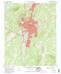
The Northwestern and Carolina railroad corridor anchors the growing industrial and residential landscape of Asheboro and North Asheboro during the early 1970s. The map captures a significant period of institutional expansion, evidenced by the Randolph Technical Institute and a burgeoning urban core featuring the City Hall, Library, and Armory. To the south, the transition from urban center to the Uwharrie National Forest is clear, with early developments in the State Zoological Park near Purgatory Mtn taking shape. Rural heritage remains visible in the surrounding hills, where family-named landmarks like Daves Mtn and Hedrick Mtn overlook numerous small country congregations, including Whispering Pines Ch and Browers Chapel Ch, and local aviation sites such as Hinshaw Airport.
Find a feature on this map
65 named features on this map. Tap any name to fly to it.
Don’t see what you’re looking for? This feature index may not catch every label — zoom into the map to look around manually.
Map Details
Editions of this 1970 Asheboro Map
2 editions found
Other maps of this area

1953 · Raleigh
USGS Topo · 1:250,000

1954 · Raleigh
USGS Topo · 1:250,000

1957 · Asheboro
USGS Topo · 1:62,500

1968 · Ramseur
USGS Topo · 1:24,000

1968 · Erect
USGS Topo · 1:24,000

1970 · Randleman
USGS Topo · 1:24,000
1970 · Glenola
USGS Topo · 1:24,000
1973 · Eleazer
USGS Topo · 1:24,000

1973 · Seagrove
USGS Topo · 1:24,000
1974 · Grays Chapel
USGS Topo · 1:24,000