Old Maps of Randolph County, North Carolina
Explore 144 old maps of Randolph County, spanning from 1949 to today. These high-resolution historic maps reveal how streets, neighborhoods, landmarks, and natural features evolved over time — perfect for genealogy, metal detecting, research, and local history exploration.
What you can do with these maps:
- See how Randolph County changed over time: Compare historical maps to modern-day views to trace roads, homesites, rail lines & more.
- View detailed metadata: Each map includes creators, publishers, year, scale, and archive source.
- Overlay maps with satellite & LiDAR: Visualize the past alongside modern tools to explore terrain & human change.
- Trusted historical sources: Maps sourced from the USGS, Library of Congress, and other archives.
- Access maps your way: View online, download high-res files, or order prints for personal or research use.
Start exploring old maps of Randolph County to uncover forgotten places, hidden landmarks, and the deep history beneath your feet.
Randolph County, NC maps
(144)- 1949 Map of High Point West, 1952 Print
 1949 High Point West1952 Print · USGSMid-century development connects High Point and Thomasville as the Southern railroad drives industrial and residential growth. Researchers can find many family-named landmarks and local schools like Ada Blair Sch, Finch Field, and the Conrad Memorial Ch Cem.2 unique versions available
 - 1950 Map of High Point East, 1964 Print
 1950 High Point East1964 Print · USGSHigh Point and its surrounding townships show a mix of rapid post-war urban growth and rural heritage during the early 1950s. Genealogists and historians can trace family-named crossroads like Kirkman Crossroads or locate early institutions such as the County Sanatorium and High Point College.3 unique versions available
 - 1951 Map of High Point East
 1951 High Point East1951 Print · USGSGuilford and Randolph counties show a maturing Piedmont landscape in the early fifties, where textile-town growth meets established rural communities. Researchers can trace family sites at Green Hill Cemetery and Hickory Chapel, or locate industrial history near Freeman Mill and the Southern rail line.
 - 1951 Map of Fair Grove, 1952 Print
 1951 Fair Grove1952 Print · USGSDavidson County in the early fifties is mapped here as a network of rail-side stations and rural parish life. Genealogists can locate family landmarks like Hannersville Station, Loflin Store, and Clarksbury Ch along the historic rail corridors.4 unique versions available
 - 1953 Map of Raleigh, 1965 Print
 1953 Raleigh1965 Print · USGSCentral North Carolina in the early sixties shows a landscape of growing towns and military hubs before the full expansion of the interstate system. Genealogists can trace family footprints across the Piedmont through Wake Forest, Siler City, and the large Fort Bragg Military Reservation.4 unique versions available
 - 1953 Map of Charlotte, 1968 Print
 1953 Charlotte1968 Print · USGSThe North Carolina Piedmont and South Carolina borderlands are shown in detail during a period of significant growth and reservoir development. Trace the rail corridors of the Southern Railway or find family roots in towns like China Grove, Misenheimer, and Lincolnton.3 unique versions available
 - 1954 Map of Charlotte
 1954 Charlotte1954 Print · USGSThe North Carolina Piedmont in the mid-1950s shows a region of rapid growth and industrial expansion centered around Charlotte. Trace the era's infrastructure through the Southern railroad lines and locate significant landmarks like the Charlotte Naval Ammunition Depot and Lake Norman.2 unique versions available
 - 1954 Map of Raleigh
 1954 Raleigh1954 Print · USGSThe North Carolina Piedmont and Sandhills are captured in the mid-fifties during a period of steady regional growth. Genealogists and historians can trace the development of towns like Siler City or locate landmarks such as Falls of Neuse and Camp Mackall.
 - 1957 Map of Denton, 1958 Print
 1957 Denton1958 Print · USGSIn the foothills of Davidson County during the late fifties, rural life centered on the banks of the Yadkin and the local rail lines. Researchers can trace family sites like Jackson Hill, rural congregations at New Jerusalem Ch, and the workings of the Silver Mine.
 - 1957 Map of Asheboro, 1959 Print
 1957 Asheboro1959 Print · USGSRandolph County's rural and industrial character is captured here during the late fifties, centered on the growing town of Asheboro. Researchers can trace old family roots at Whynot, locate the State Prison (Camp 406), or find numerous rural landmarks like Tabernacle Sch and Callicutts Ch.2 unique versions available
 - 1960 Map of Charlotte
 1960 Charlotte1960 Print · USGSMid-century North Carolina and South Carolina meet in this 1960 survey of the Piedmont's industrial and textile heartland. Trace the growth of Charlotte alongside historic landmarks like Kings Mountain National Military Park and the Charlotte Naval Ammunition Depot.2 unique versions available
 - 1962 Map of Charlotte
 1962 Charlotte1962 Print · USGSThe North Carolina Piedmont in the early sixties showcases a landscape transformed by massive reservoirs and industrial growth. Researchers can trace the development of Lake Norman, locate the Charlotte Naval Ammunition Depot, or find family landmarks like Wesley Chapel and Brown & Norcott Mills.
 - 1968 Map of Ramseur, 1973 Print
 1968 Ramseur1973 Print · USGSThe industrial corridor of the Deep River in the late 1960s is preserved here, showing the mill towns of Ramseur and Franklinville at a peak of rail activity. Researchers can trace rural lineages through numerous country landmarks like Spoons Chapel, Mt Tabor Ch, and the Old Salem Cem.2 unique versions available
 - 1968 Map of Coleridge, 1973 Print
 1968 Coleridge1973 Print · USGSRandolph and Chatham Counties are captured here in the late sixties as the rural Piedmont landscape maintained its traditional crossroads character. Genealogists and local historians can trace family-named sites like Browns Crossroads and local sanctuaries such as New Lambert Chapel and Jordan Grove Church.
 - 1968 Map of Erect, 1973 Print
 1968 Erect1973 Print · USGSNorth Carolina's Piedmont hills are revealed here in the late sixties, highlighting the rural pottery and farming communities of Randolph and Moore counties. Genealogists can locate family landmarks like Jugtown, Yow Mill, and Needhams Grove Ch.
 - 1968 Map of Bennett, 1973 Print
 1968 Bennett1973 Print · USGSThe rural tri-county borderlands of Chatham, Randolph, and Moore counties are captured here in the late sixties. Researchers can trace family roots through numerous local landmarks like Maple Springs Ch, Mt Zion Ch, and the settlement at Bennett.
 - 1969 Map of High Point West, 1973 Print
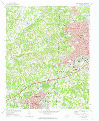 1969 High Point West1973 Print · USGSThe industrial corridor between High Point and Thomasville is captured here in the late sixties as urban growth began to bridge the county lines. Genealogists and local historians can locate legacy institutions like Zion Ch, Oakwood Cem, and the specialized High Point Thomasville and Denton RR.2 unique versions available
 - 1970 Map of Kimesville, 1973 Print
 1970 Kimesville1973 Print · USGSThe rural tri-county border area of Guilford, Alamance, and Randolph was a landscape of small churches and local airfields in the early 1970s. Researchers can trace family sites like Greene Sch and the Hornaday Pleasant Union Ch Cem or locate Causey Airfield.2 unique versions available
 - 1970 Map of Pleasant Garden, 1973 Print
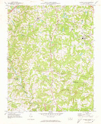 1970 Pleasant Garden1973 Print · USGSThe Piedmont countryside of Guilford and Randolph Counties is captured here in the early seventies as rural life and new growth intersected. Local historians can trace old homesteads near Burnetts Chapel, the railroad tracks through Pleasant Garden, and the winding Deep River.2 unique versions available
 - 1970 Map of Climax, 1973 Print
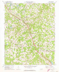 1970 Climax1973 Print · USGSThe North Carolina Piedmont south of Greensboro was undergoing significant growth in the 1970s. Researchers can trace the rural roots of Climax and Julian while locating family landmarks like the Love Ch Cem, Bethel Ch Cem, and Shiloh Ch.2 unique versions available
 - 1970 Map of Randleman, 1973 Print
 1970 Randleman1973 Print · USGSRandolph County's industrial and rural landscape comes into focus in the early 1970s as the river-driven towns of Worthville and Central Falls thrive. Researchers can trace the legacy of local congregations at Old Union Ch and New Salem Ch or locate the site of the Drive-in Theater.2 unique versions available
 - 1970 Map of Glenola, 1973 Print
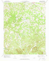 1970 Glenola1973 Print · USGSRandolph County's rural landscape is depicted here in the early seventies, showing a network of small crossroad communities and mountain ridges. Genealogists can locate family landmarks like Poplar Ridge Ch, Glenola, and the Covered Bridge over the Little Uwharrie River.2 unique versions available
 - 1970 Map of Asheboro, 1974 Print
 1970 Asheboro1974 Print · USGSAsheboro and its surrounding Piedmont hills come into focus in the early seventies during a era of significant growth. Researchers can trace local landmarks like Hinshaw Airport, the Northwestern and Carolina rail line, and the emerging State Zoological Park.2 unique versions available
 - 1973 Map of Eleazer, 1976 Print
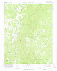 1973 Eleazer1976 Print · USGSThe rural landscapes of southern Randolph County are captured here in the early seventies, just as the Uwharrie highlands remained a quiet patchwork of forest and farm. Genealogists can trace the locations of historic congregations at Strieby Ch and Mt Lebanon Ch or find the remote settlement of Eleazer.
 - 1973 Map of Seagrove, 1977 Print
 1973 Seagrove1977 Print · USGSThe rural communities of Randolph and Montgomery counties are captured here in the early 1970s as the local economy transitioned from traditional farming. Genealogists can locate family landmarks such as Center Cross Ch, Fairview Ch, and the crossroads at Whynot.
Showing maps 1-25 of 144
Top cities of Randolph County
- Asheboro historical maps
- Archdale historical maps
- Trinity historical maps
- Randleman historical maps
- Liberty historical maps
- Ramseur historical maps
See more
Frequently asked questions
- What are the different types of historical maps available for Randolph County?
- What is the oldest map of Randolph County?
- Where can I purchase historical maps of Randolph County for my home or office?
- Where can I download high-res historical maps of Randolph County?
- Are there historical topographic maps available for Randolph County?
- Is there historical aerial imagery available for Randolph County?
- Where are historical maps of Randolph County sourced from?