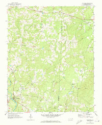
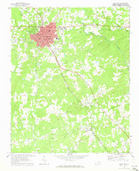
1968 Map of Coleridge
USGS Topo · Published 1973About this map
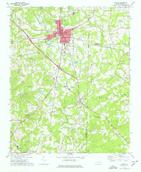
Deep River winds through the southwestern corner of this Piedmont landscape, anchoring the community of Coleridge, where the Concord Cemetery and several local branches meet. The terrain is defined by a dense network of tributaries including Little Brush Creek and Blood Brush Creek that drain the timbered ridges along the Randolph and Chatham County line. This late 1960s survey illustrates a rural social fabric built around crossroads and country congregations, evidenced by prominent landmarks like Moons Chapel and Kildee Wesleyan Church. While agricultural and residential patterns predominate, industrial and modern infrastructure begin to mark the land, seen in the Gravel Pit near Parks Crossroads and the Siler City Municipal Airport located on the eastern edge of the quadrangle.
Find a feature on this map
25 named features on this map. Tap any name to fly to it.
Don’t see what you’re looking for? This feature index may not catch every label — zoom into the map to look around manually.
Map Details
Editions of this 1968 Coleridge Map
This is the sole edition of this map. No revisions or reprints were ever made.
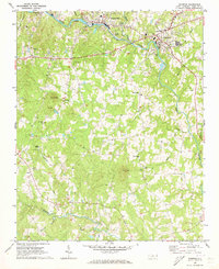
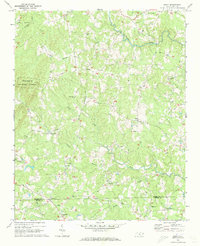
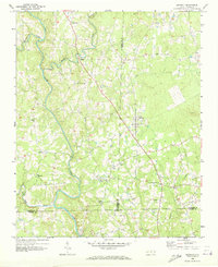
Other maps of this area

1953 · Raleigh
USGS Topo · 1:250,000

1954 · Raleigh
USGS Topo · 1:250,000
1968 · Ramseur
USGS Topo · 1:24,000
1968 · Erect
USGS Topo · 1:24,000
1968 · Bennett
USGS Topo · 1:24,000
1969 · Siler City
USGS Topo · 1:24,000
1970 · Bear Creek
USGS Topo · 1:24,000
1974 · Crutchfield Crossroads
USGS Topo · 1:24,000
1974 · Grays Chapel
USGS Topo · 1:24,000
1974 · Liberty
USGS Topo · 1:24,000