1960s Maps of Randolph County, North Carolina
Explore 7 historic maps of Randolph County from the 1960s. These maps offer a rare glimpse into what life looked like during the 1960s — showing old roads, neighborhoods, homes, and landmarks that have changed or disappeared over time.
Whether you're researching your family's past, planning a metal detecting trip, or studying how Randolph County's landscape evolved across the 1960s, these high-resolution maps are a powerful tool for exploring the history of this region.
- Focus on a specific era: All maps on this page are from the 1960s, giving you a focused view of this time period.
- See what’s changed: Compare century-old streets, trails, and buildings to today's modern landscape using overlays and satellite layers.
- Research with precision: Use these maps for genealogy, historical research, land use analysis, or educational projects.
- View, download, or print: Maps are fully viewable online in high resolution, and can be downloaded or printed for your own records.
Start exploring Randolph County's history through authentic maps from the 1960s. This is your window into the past.
Randolph County, NC maps
(7)- 1960 Map of Charlotte
 1960 Charlotte1960 Print · USGSMid-century North Carolina and South Carolina meet in this 1960 survey of the Piedmont's industrial and textile heartland. Trace the growth of Charlotte alongside historic landmarks like Kings Mountain National Military Park and the Charlotte Naval Ammunition Depot.2 unique versions available
 - 1962 Map of Charlotte
 1962 Charlotte1962 Print · USGSThe North Carolina Piedmont in the early sixties showcases a landscape transformed by massive reservoirs and industrial growth. Researchers can trace the development of Lake Norman, locate the Charlotte Naval Ammunition Depot, or find family landmarks like Wesley Chapel and Brown & Norcott Mills.
 - 1968 Map of Ramseur, 1973 Print
 1968 Ramseur1973 Print · USGSThe industrial corridor of the Deep River in the late 1960s is preserved here, showing the mill towns of Ramseur and Franklinville at a peak of rail activity. Researchers can trace rural lineages through numerous country landmarks like Spoons Chapel, Mt Tabor Ch, and the Old Salem Cem.2 unique versions available
 - 1968 Map of Coleridge, 1973 Print
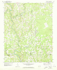
 1968 Coleridge1973 Print · USGSRandolph and Chatham Counties are captured here in the late sixties as the rural Piedmont landscape maintained its traditional crossroads character. Genealogists and local historians can trace family-named sites like Browns Crossroads and local sanctuaries such as New Lambert Chapel and Jordan Grove Church.
 - 1968 Map of Erect, 1973 Print
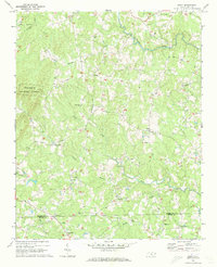 1968 Erect1973 Print · USGSNorth Carolina's Piedmont hills are revealed here in the late sixties, highlighting the rural pottery and farming communities of Randolph and Moore counties. Genealogists can locate family landmarks like Jugtown, Yow Mill, and Needhams Grove Ch.
 - 1968 Map of Bennett, 1973 Print
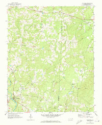
 1968 Bennett1973 Print · USGSThe rural tri-county borderlands of Chatham, Randolph, and Moore counties are captured here in the late sixties. Researchers can trace family roots through numerous local landmarks like Maple Springs Ch, Mt Zion Ch, and the settlement at Bennett.
 - 1969 Map of High Point West, 1973 Print
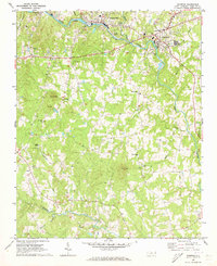
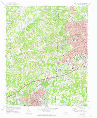 1969 High Point West1973 Print · USGSThe industrial corridor between High Point and Thomasville is captured here in the late sixties as urban growth began to bridge the county lines. Genealogists and local historians can locate legacy institutions like Zion Ch, Oakwood Cem, and the specialized High Point Thomasville and Denton RR.2 unique versions available
End of results
Showing maps 1-7 of 7
Top cities of Randolph County
- Asheboro historical maps
- Archdale historical maps
- Trinity historical maps
- Randleman historical maps
- Liberty historical maps
- Ramseur historical maps
See more
Frequently asked questions
- What are the different types of historical maps available for Randolph County?
- What is the oldest map of Randolph County?
- Where can I purchase historical maps of Randolph County for my home or office?
- Where can I download high-res historical maps of Randolph County?
- Are there historical topographic maps available for Randolph County?
- Is there historical aerial imagery available for Randolph County?
- Where are historical maps of Randolph County sourced from?