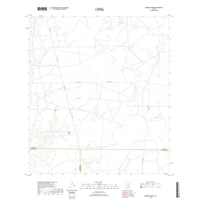
2019 Map of Albercas Ranch
USGS Topo · Published 2019About this map
Albercas Ranch anchors this South Texas landscape where the borders of Webb, Zapata, and Jim Hogg counties meet. The terrain is defined by a network of intermittent watercourses including Aqua Azul Cr, Albercas Cr, and Arroyo Grande, which illustrate the drainage patterns characteristic of the Tamaulipan mezquital. The presence of Albercas de San Felipe Spring indicates the critical role of reliable water sources in this semi-arid ranching country. Transportation is facilitated by a grid of rural routes such as Ranch Rd 649 and Ranch Rd 8030A, while the Jacalon Ranch Airport provides an essential aerial link for this isolated region. This survey captures the enduring ranching footprint and the intricate boundary lines that divide these historic Texas counties.
Find a feature on this map
13 named features on this map. Tap any name to fly to it.
Don’t see what you’re looking for? This feature index may not catch every label — zoom into the map to look around manually.
Map Details
Editions of this 2019 Albercas Ranch Map
This is the sole edition of this map. No revisions or reprints were ever made.
Other maps of this area

1939 · Bruni
USGS Topo · 1:62,500

1939 · Randado
USGS Topo · 1:62,500

1940 · Aguilares
USGS Topo · 1:62,500

1940 · Randado
USGS Topo · 1:62,500

1940 · Mogotes Hill
USGS Topo · 1:62,500

1956 · Mogotes Hill
USGS Topo · 1:62,500

1956 · Laredo
USGS Topo · 1:250,000

1972 · Armstrong Ranch
USGS Topo · 1:24,000

1972 · Albercas Ranch
USGS Topo · 1:24,000

1972 · Bruni SE
USGS Topo · 1:24,000