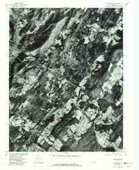
1979 Map of Alberene
USGS Topo · Published 1982About this map
The Soapstone-quarrying legacy of Alberene is etched into the landscape of south-central Albemarle County, where this orthophotograph documents a patchwork of dense timber and cleared clearings at the end of the 1970s. The hydrology of the region is defined by the Hardware River and its major tributaries, including the North Fork and South Fork, which converge near Carters Bridge. Small upland clearings and crossroads like Powell Corner and Red Hill dot the terrain between the river valleys and high points such as Round Top. Unlike a traditional line-drawn map, this photographic survey reveals the actual ground cover and building footprints of the era, providing a realistic view of rural Virginia before modern development intensified. From the waters of Reynolds Lake to the drainage of Eppes Creek, the map highlights the enduring agricultural and residential patterns of this part of the Piedmont.
Find a feature on this map
10 named features on this map. Tap any name to fly to it.
Don’t see what you’re looking for? This feature index may not catch every label — zoom into the map to look around manually.
Map Details
Editions of this 1979 Alberene Map
This is the sole edition of this map. No revisions or reprints were ever made.
Other maps of this area

1891 · Palmyra
USGS Topo · 1:125,000

1892 · Buckingham
USGS Topo · 1:125,000

1892 · Gordonsville
USGS Topo · 1:125,000

1892 · Harrisonburg
USGS Topo · 1:125,000

1895 · Palmyra
USGS Topo · 1:125,000

1897 · Palmyra
USGS Topo · 1:125,000

1929 · Covesville
USGS Topo · 1:62,500

1931 · University
USGS Topo · 1:62,500

1935 · Charlottesville
USGS Topo · 1:62,500

1935 · Charlottesville And Vicinity
USGS Topo · 1:31,680