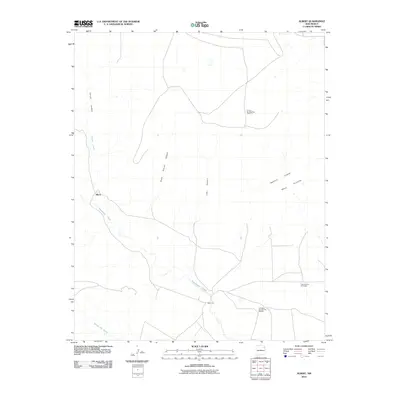
2010 Map of Albert
USGS Topo · Published 2010About this map
Albert and the nearby Albert P O anchor this landscape in Harding County, where drainage networks and mesa topography dictate the local geography. The area is defined by the flow of Tequesquite Creek and Carrizo Creek, which carve deep paths through the terrain alongside features like Carrizo Canyon and Plum Rincon Canyon. Beyond the natural drainage of Arroyo del Alamo, the map reveals a landscape influenced by modern resource extraction and land management. Industrial labels such as Amoco Number One State F C and Amerigas Number Six Mitchell point to the ongoing intersection of energy interests and rural ranching life. This topography of Mesa Quitaras and its surrounding canyons illustrates the persistent, sparse settlement patterns of northeastern New Mexico in the early twenty-first century.
Find a feature on this map
13 named features on this map. Tap any name to fly to it.
Don’t see what you’re looking for? This feature index may not catch every label — zoom into the map to look around manually.
Map Details
Editions of this 2010 Albert Map
This is the sole edition of this map. No revisions or reprints were ever made.
Other maps of this area

1954 · Tucumcari
USGS Topo · 1:250,000

1954 · Dalhart
USGS Topo · 1:250,000

1958 · Tucumcari
USGS Topo · 1:250,000

1958 · Dalhart
USGS Topo · 1:250,000

1962 · Dalhart
USGS Topo · 1:250,000

1973 · Circle Bar Ranch
USGS Topo · 1:24,000

1973 · Yates SE
USGS Topo · 1:24,000

1973 · Mosquero
USGS Topo · 1:24,000

1973 · Sabino
USGS Topo · 1:24,000
1973 · Bueyeros
USGS Topo · 1:24,000